Welcome to Adopted Plans and Studies
The following Plans and Studies are available though the linked image provided or by visiting the ICOPD during business hours for a paper copy available for the cost of reproduction:
Kiski-Conemaugh River Conservation Plan, 1999
In 1999, a coalition of environmental groups concerned with the conservation and preservation of the Kiski- Conemaugh Basin was developed to conserve, restore, and enhance the entire Kiski-Conemaugh River Basin. The document identifies geographic and demographic attributes, cultural resources, and environmental hazards such as acid mine drainage. The plan develops recommendations for maintaining and improving historic assets, recreation opportunities, and scenic beauty throughout the basin.
* The Kiski-Conemaugh River Conservation Plan is not currently available in an electronic format.
Growth and Revitalization Plan, 2000
* The Growth and Revitalization Plan is not currently available in an electronic format.
Clymer Borough Comprehensive Plan, 2000
Through the comprehensive planning process, Clymer Borough has examined its past history and land development patterns in order to uncover trends and characteristics of Clymer’s population, housing, land use, environment, parks, community facilities, public utilities and transportation network. To manage future community growth and development twelve (12) Community Goals and Objectives were created as guidelines. These guidelines range from revitalizing the Main Street/Downtown area and initiate a marketing strategy to attract new shoppers to Clymer to creating links within the community through the development of trails and/or pathways which will provide safe access to the downtown area and recreation facilities.
Indiana Multimodal Mobility Study, 2003
Herbert, Rowland & Grubic, Inc. (HRG), in cooperation with Graney, Grossman, Colosimo and Associates (GGCA), is pleased to present the results of the Indiana Multimodal Mobility Study. The study area includes Indiana Borough and portions of White Township and is generally bounded by U.S. 422 in the south and west, U.S. 119 in the east, and the Indiana Senior High School and Junior High School areas in the north.
The objectives of the study were to identify ways to preserve the operational effectiveness of the transportation network while improving safety across all modes and providing for future community growth. This was accomplished by gathering and analyzing existing traffic conditions in the study area, projecting future traffic conditions in the study area using socio-economic analysis and land use projections, and recommending conceptual transportation improvements and land use policy changes based on short-term and long-term conditions. This study has been conducted in accordance with the Institute of Transportation Engineers (ITE) guidelines, PENNDOT criteria, and applicable municipal guidelines.
Southern Indiana County Cooperative Communities Comprehensive Plan, 2004
The Southern Indiana Cooperative Communities Comprehensive Plan was prepared in accordance with the Pennsylvania Municipalities Planning Code (Act 170 of 1988). Although the plan is not a legally binding document, once adopted it is the official statement for future development in the respective communities.
the comprehensive plan is the only public document that describes the community as a whole in terms of its complex and mutually supporting networks. The plan contains policy statements, developed by the community and adopted by its officials, which are used to support community decisions and anticipate future conditions.
Congested Corridor Improvement Program, 2006
The Pennsylvania Department of Transportation (PennDOT) initiated the Congested Corridor Improvement Program (CCIP) to identify congested corridors in the Commonwealth and, in conjunction with its partners, define and implement the needed improvements. A Standard Study Methodology (SSM) was developed as part of the CCIP to provide a uniform approach to identify improvements and assess their effectiveness in accordance with the goal of the program. The SSM identifies the steps involved in an engineering study of improvement alternatives and focuses on the use of simulation models as analysis tools to evaluate the operational impacts of those alternatives.
Based on an evaluation of the suitability for the CCIP, the Philadelphia Street corridor was included in the program. The study corridor is located in PennDOT Engineering District 10-0 within Indiana County, and extends from US 422 Business to South 3rd Street. It is contained within the Borough of Indiana and White Township, is 2.66 miles in length, and includes 10 signalized intersections.
Indiana County Comprehensive Recreation, Park, and Open Space, 2006
Recognizing the importance of parks and recreation to the County, this Comprehensive Recreation and Parks Plan was initiated. The process used to develop this Plan included extensive public input, detailed inventory and assessment, and the development of recommendations for the future of parks and recreation in Indiana County.
When planning for the future of parks and recreation in Indiana County, it is important to develop an understanding of the County as a whole. Information on demographics and community resources gathered through the County Comprehensive Planning process provided a context within which this Comprehensive Recreation and Parks Plan was generated. A familiarity with this information ensures the development of a plan that is realistic, sensitive to current issues, and tailored to this unique County.
Indiana County Open Space, Greenways, and Trails Plan, 2010
The Indiana County Open Space , Greenways and Trails Plan to designate a system of greenways is an extension of work that began with the County’s Comprehensive Parks and Recreation Plan. In creating this greenways system, or what is often referred to as a network, the County and its municipalities can work together to strategically provide unique recreation and conservation opportunities to residents and visitors. As part of this effort, several natural resource planning principles are important to consider:
A. Identified greenways can be comprised of recreation and conservation-oriented corridors and open spaces.
B. A network of greenways can exist in urban, suburban and rural landscapes.
C. Opportunity exists to develop greenway connections across county boundaries.
Clymer Borough Parks Master Plan, 2011
Indiana County Bicycle and Pedestrian Transportation Plan, 2011
More People Biking & Walking More Often is an official policy document for Indiana County, Pennsylvania. It provides policy and facility recommendations for improving bicycle and pedestrian conditions, and fostering a culture that encourages bicycling and walking throughout Indiana County.
In 2006 the Indiana County Board of Commissioners appointed a 12-member Steering Committee, of county residents and representatives from organizations with expertise to oversee development of the final Plan. The Steering Committee met regularly to establish a vision for Indiana County and to update the goals, objectives, and action strategies necessary to achieve the vision for Indiana County.
The Steering Committee also discussed engineering, enforcement, and education which are necessary to addressing transportation safety. Based on a shared belief that creating a culture that embraces bicycling and walking is more about encouraging people to ride and walk than about developing new facilities and striping bike lanes, the Committee added encouragement as a fourth element. Evaluation was added as a fifth element and includes recommendations to regularly determine progress in reaching the identified vision and goals. The Committee adopted these elements as guiding principles throughout Plan development.
Indiana County Natural Heritage Inventory, 2011
The Indiana County Natural Heritage Inventory (CNHI) was developed in 2011 to served as a way to both gather new information and to pass along new and existing information to those responsible for land use decisions, as well as to all residents who wish to know more about the natural heritage of their county. The Indiana CNHI foacuses on the best examples of living ecological resources in the county. This inventory presents the known outstanding natural features in the county, and maps the locations of the best habitats (natural communities) and plant and animal species of concern along with recommendations for their preservation.
Where We Live... A Comprehensive Plan for Indiana County, Pennsylvania, 2012
Where We Live... A Comprehensive Plan for Indiana County, Pennsylvania is the guiding document for county-wide planning efforts. The plan examines subjects such as community facilities and utilities, natural resources, transportation, and future land uses. The comprehensive plan was developed to guide Indiana County for the next 20 years. A five-year action plan was created at the end of the document to link action items with responsible entities, possible funding sources and a time frame on implementation.
On September 12, 2012 the County of Indiana adopted the comprehensive plan. The County's Planning Commission and Planning Staff have begun to undertake implementation of the documents five-year action plan.
Indiana County Housing Plan, 2014
The 2014 Indiana County Housing Plan is a detailed examination of housing conditions across Indiana County. The Plan examines municipalities through a classification called a neighborhood typology. This classification allows for action strategies to be utilized to solve issues in multiple municipalities. The document will be guiding investment for housing in Indiana County for the next 10 years.
Indiana County Stormwater Management Plan- Phase One, 2015

The Indiana County Act 167 Stormwater Management Plan- Phase One document, which was adopted in March of 2015 includes the scope of study and targets problem areas to be addressed in the Phase Two Planning Document. The ICOPD is actively planning for the Phase Two planning process.
Indiana Community University District Master Plan, 2016
The Indiana Community University District Master Plan is a highly-focused planning effort in the areas around the Indiana University of Pennsylvania (IUP) campus. This project, the first of its kind in Indiana, has been a joint planning initiative developed by Indiana Borough, White Township, IUP, and Indiana County. It’s specific focus or components include housing, transportation/mobility, open space, and economic development
In April, 2014 the Indiana County Commissioners approved the selection of SmithGroupJJR to lead this joint community - university planning effort. SmithGroupJJR is one of the nation's largest architecture, engineering and planning firms that employs more than 800 professionals in10 offices and a recognized leader in “campus-edge” planning.
In the fall of 2014, the project brought together residents, developers, students, planners, and design and community development professionals in a series of community design workshops that were held at the Kovalchick Convention and Athletic Complex. These multi-day workshops attracted over 500 attendees who were lead through a series of facilitated sessions designed to “rethink” the areas around the IUP campus. The product of these highly-interactive sessions is a graphic planning document and detailed action strategy designed to implement the ingredients of the Master Plan.
On January 20, 2016, the final draft of the Indiana Community University District Master Plan was released to the public. A digital copy of the plan can be downloaded HERE and a hard-copy is available for review at the municipal offices of all the project partners listed above (Indiana Borough, White Township) and at the Indiana County Office of Planning & Development.
Report of the Indiana County Sustainable Economic Development Task Force, 2018
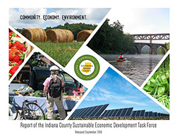
The Final Report developed by the Indiana County Sustainable Economic Development Task Force identifies new opportunities for economic development, citizen education and job training / workforce development within the following areas:
• Renewable Energy Sector
• Innovative Agriculture
• Sustainable building construction, renovation and restoration
• Wise use of the County’s natural resources
The report is intended to provide recommendations in these areas to help guide the County’s progress as a sustainable community.
White Township Comprehensive Plan, 2020
In 2009, White Township completed a Township-wide comprehensive planning effort that resulted in the adoption of the White Township Comprehensive Plan. The Plan focused on promoting the preservation of green areas within the context of a developing community, create an overall guide for development, avoid the promotion of suburban sprawl, and revitalize the township's older commercial corridor, in addition to other objectives. The plan will act as the guiding document for the township for the next 20 years. The plan was updated in 2020.
Indiana County Active Transportation Plan, 2021
The Office of Planning & Development, in cooperation with The EADS Group, Inc., Thomas R. Harley Architects, LLC., the Southwestern Pennsylvania Commission (SPC), and the project Steering Committee, is developing the Indiana County Active Transportation Plan Update. This document will serve as an update to the County’s current bicycle/pedestrian plan titled More People Biking & Walking More Often: Pedestrian & Bicyclist Transportation Plan for Indiana County (adopted in 2012).
The primary goal of the proposed project is to plan for a more connected transportation system and identify opportunities that encourage biking/walking and transit use across the County.
Starting in September 2021, the project team engaged the community through four regional public input meetings held in Indiana, Blairsville, Saltsburg, and Marion Center. A web-based comment mapping application and community survey were developed (and also made available in printed form at public input meetings). Additionally, sixteen (16) Key Person Interviews were conducted during the planning process. For more details, please see SECTION 2: COMMUNITY ENGAGEMENT of the Plan Update.
Indiana Borough Comprehensive Plan, 2024
The INDIANA2030 plan is an updated comprehensive plan for Indiana Borough, building on the 2011 version. It details the current environment, future goals, and strategies for local government, partners, and key institutions. This plan is intended to be dynamic, with updates occurring at least every ten years or as needed.
The development of INDIANA2030, or "Tomorrow Together," was a six-year effort, starting with the Borough Planning Commission in 2018 and continuing with a consultant team from 2023 to 2024. This collaborative process involved understanding current conditions, identifying core values, and generating ideas for the future of the Indiana community.
Homer City Borough & Center Township - Get Ready: A Community-led Strategy, 2025
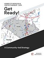
Homer City Borough and Center Township have a history deeply tied to the energy sector. Coal and natural gas were the backbone of the local economy, fueling not just our region but the wider country. However, with shifts in the energy landscape, these communities have seen some tough economic times, including job losses. Now, the focus is on figuring out how to adapt and build a more sustainable future. This document takes a look at the current situation and explores some promising, community-driven ideas for growth and development.
Phone: (724) 465-3870
Fax: (724) 465-3151
801 Water St.
Indiana, PA 15701-1705
Office Hours:
8:30 a.m. to 4:30 p.m.
Monday - Friday EST


